

RESOURCES & INSIGHTS
Stay ahead with the latest in precision agriculture, soil insights, case studies and product updates.

RESOURCES & INSIGHTS
Stay ahead with the latest in precision agriculture, soil insights, case studies and product updates.
01 / HIGH RAINFALL AGZONE 6 / 12 NOVEMBER 2024
Same rate.
Every hectare.
At what cost?
See how matching inputs to soil needs could change the budget.
Complete the form to access the full comparison and report
Across a 4,400 ha scenario
Before $132,000 in service costs.
HRZ report · November 2024
30-second overview · Sound optional
Video unavailable. You can still view the full case study.
Complete the access form
02 / BUSINESS CASE
Wheatbelt Farms
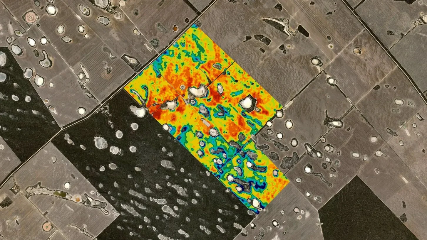
In early 2022, VRT Solutions surveyed 523.79 ha of arable land at the NewFarm block using two soil-mapping sensors. The survey identified soils with different nutrient needs and responses to soil amendments. The report shows how these differences can guide management zones for variable-rate applications.
VARIABLE RATE CASE STUDY — HIGH RAINFALL AGZONE 6
One cost scenario.
Two input plans.
12 November 2024
MODELLED INPUT-COST DIFFERENCE
$442,220
About 32% lower input costs · 4,400 ha scenario
Before $132,000 in service costs.
Input costs · AUD
Source: HRZ report, p.5 · November 2024
01 / WHERE THE DIFFERENCE COMES FROM
The biggest cost difference was in lime and gypsum.
Lime
Soil acidity
Gypsum
Soil structure & sulphur
MAP
Starter fertiliser
MOP
Potassium fertiliser
Source: HRZ report, p.5 · All product bars share a $0–$440,000 scale.
02 / THE DECISION BEHIND THE NUMBERS
Less where it’s enough.
More where it’s needed.
Match inputs to soil and crop needs. In this case, some potassium-deficient areas were allocated more MOP than under the blanket plan.
03 / THE EVIDENCE BEHIND THE PLAN
Different soils.
Different input plans.
THE SOIL PROFILES
Visible soil differences
Original soil-core photographs · Report p.2
Illustrative soil profiles; not test results or matched prescription zones.
THE MAP PRESCRIPTION
MAP prescription example
70 / 80 / 90 kg/ha MAP product
WHAT ABOUT YOUR FARM?
Could you spend less
on inputs?
Let’s look at what could work on your farm.

Variable Rate | Case Study
Costs of inputs for broadacre farming have increased substantially over the past 3-4 years. Of these, phosphorus-based starter fertiliser, potassium fertiliser, lime and gypsum are now becoming highly expensive upfront investments. Taking a blanket application approach is fast becoming an uneconomical strategy, with more growers opting to use variable rate (VR) technology to not only reduce their overall spend but also apply their fertiliser and ameliorants more strategically.
Applying less fertiliser does not have to cost yield; in fact, by using correctly analysed electromagnetic and gamma radiometric surveying data in conjunction with targeted soil testing can maintain and even increase crop yields.

“Wheatbelt Farms” | Business Case
Soil mapping in agricultural scenarios has been gaining popularity over the past 12-15 years. The reasons for this are many, understanding soil variability allows farming businesses to evaluate the potential or risks associated with the majority of applications to the land. Soil mapping allows clearer focus on budgeting, workload, time management, and reduces greatly the misappropriation of products and chemistry to the land. This allows for a much greater efficacy of the investment dollar and time management, while mitigating risk.
Soil surveying or soil mapping consists of two sensors which operate in differing ways to each other to effectively map soil types. VRT Solutions have successfully soil surveyed the “NewFarm” block of the “Wheatbelt Farms” in early 2022 which amounted to 523.79ha arable land. Within this block, there are several soil types, which will react to the addition of soil ameliorants in varying ways, not to mention have differing nutrition requirements. The soil survey will assist “Wheatbelt Farms” into the future by managing these soil types into “zones” where a variable rate approach will be undertaken.